
| Mt. Robson is a peak that I've
been trying to climb since 1998. By
Colorado standards it isn't very high – 12,972' above sea level – but
it's the highest peak in the Canadian Rockies, and it rises an awesome 10,000' from the trailhead to the summit – more vertical relief than any peak in the "Lower 48", and on a par with the giant peaks of Alaska and the Yukon. Because of its height and position at the northern end of the range it's notorious for bad weather, and the summit is often hidden in clouds while peaks all around bask in sunshine. The climbing season is generally only a couple of weeks a year, and some years it never arrives at all. In 2005, the last time I tried the mountain, we turned around when it started snowing shortly after we set out for the summit. I came back to the Canadian Rockies in 2006 hoping to try it again but the weather in the area was so poor that we didn't even bother driving there; instead we did some climbs further south. This year, as in 2005, we attempted the mountain by the south face, the standard "easy" route. It's not the most aesthetic line on the mountain, but it has a couple of advantages: it only takes two or three days to get up and down (as opposed to five or six days for climbs such as the Kain face on the other side of the mountain); and there's a bivouac hut half-way up. On the other hand, it's quite a scary climb; there are a couple of sections where one has to traverse below overhanging seracs that are poised to collapse at any moment. My trip began with a flight to Calgary, where I arrived on August 11, 2007 and was met at the airport by my climbing partner, Mike Haponiuk. We hopped into Mike's Honda Civic and drove 500 km north to the BC Provincial Park campsite at the base of the mountain, where we spent the night. Unfortunately, the next morning we woke to overcast skies and steady drizzle. We were wondering what we should do with the day when Mike discovered that he'd left his mountaineering boots at home in Edmonton, 450 km away. So we got back in his Honda, drove to Edmonton, picked up his boots and drove back to the campsite, all in one long day. It was an inauspicious start to the trip, but fortunately things improved from there. |
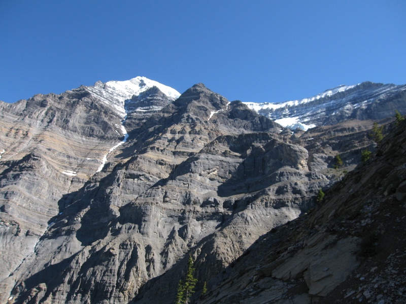
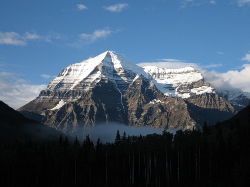 That evening the skies cleared and we were treated to this classic view of Robson's south face. There was a fair amount of new snow higher up on the mountain, but we figured that by the time we got there it would have had at least a day to melt or consolidate, so we decided to set out the following morning. |
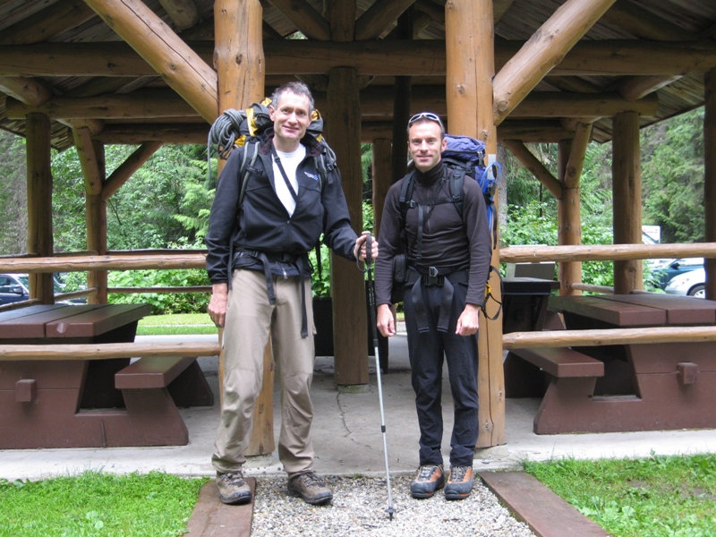 The next day dawned clear, so we packed up and headed out. The approach hike starts in very civilized fashion, at a large parking lot and shelter that marks the beginning of the popular Berg Lake Trail. |
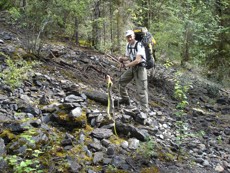 After about 5 km, however, one leaves the main Berg Lake trail and turns onto a faint track that climbs up steep forested slopes. This turnoff is quite elusive and in 2005 we blundered about in thick bush trying to find it; this time we knew exactly where to to look. |
 This is fairly typical of the lower section of the approach trail (it goes straight uphill at this point). Everything was still muddy and wet from the previous day's rain and our pants were soaked by the time we arrived at the hut. |
 Eventually the trail reaches tree-line, at which point the steep slippery mud gives way to steep loose scree. (By this stage the clouds had rolled in and light snow was falling.) There are also a couple of short cliff-bands one has to scramble up – fortunately the steeper sections are equipped with chains. |
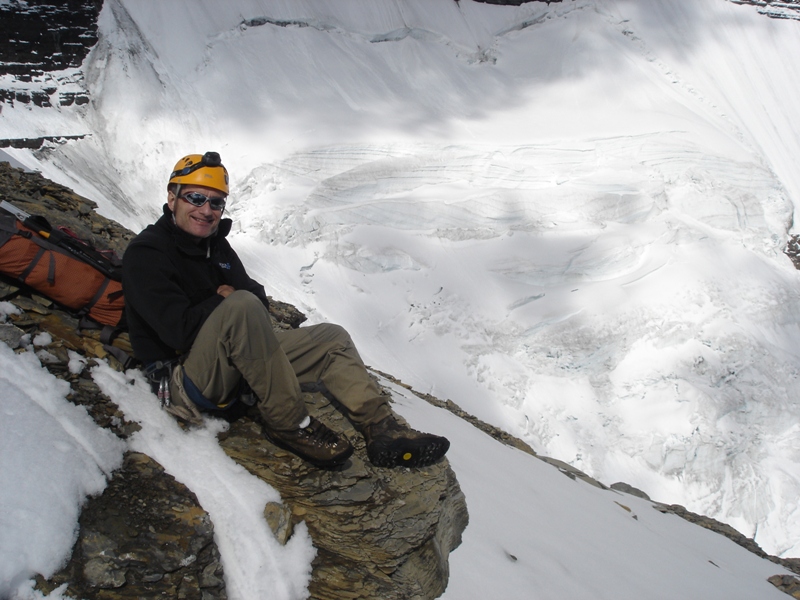
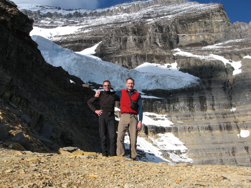
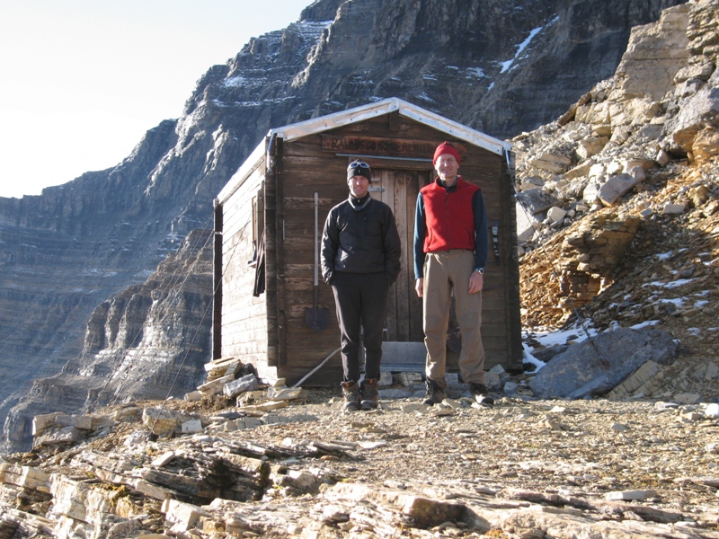 After six hours of unrelenting uphill we finally reached the Ralph Forster bivouac hut, perched precariously on a ledge at about 8,200'. |
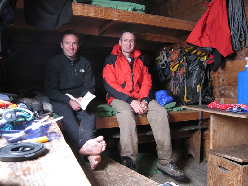 The Forster hut is a cozy affair that theoretically sleeps six people, but you probably wouldn't want to be one of those six. |
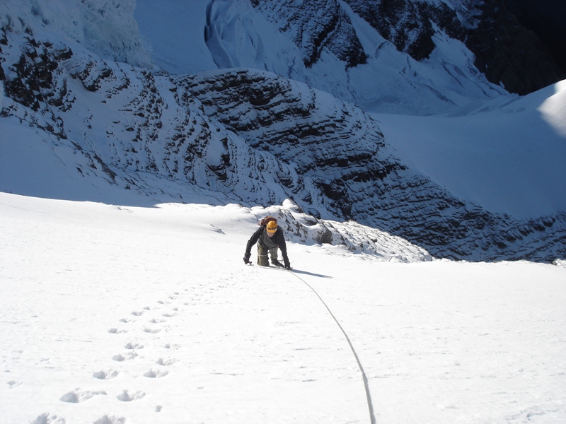
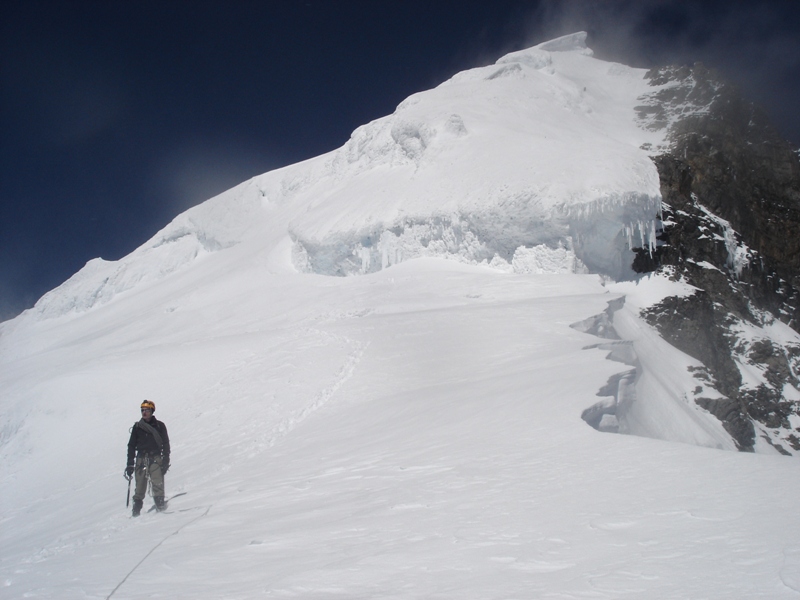
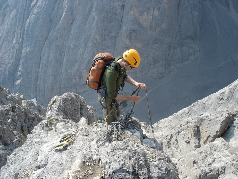
 This is the view looking uphill from the hut shortly after we arrived. From here one skirts below the ominous seracs, then scrambles up the rock buttress on the left ("Little Robson"). The summit was still hidden in clouds, but towards nightfall the sky began to clear. |
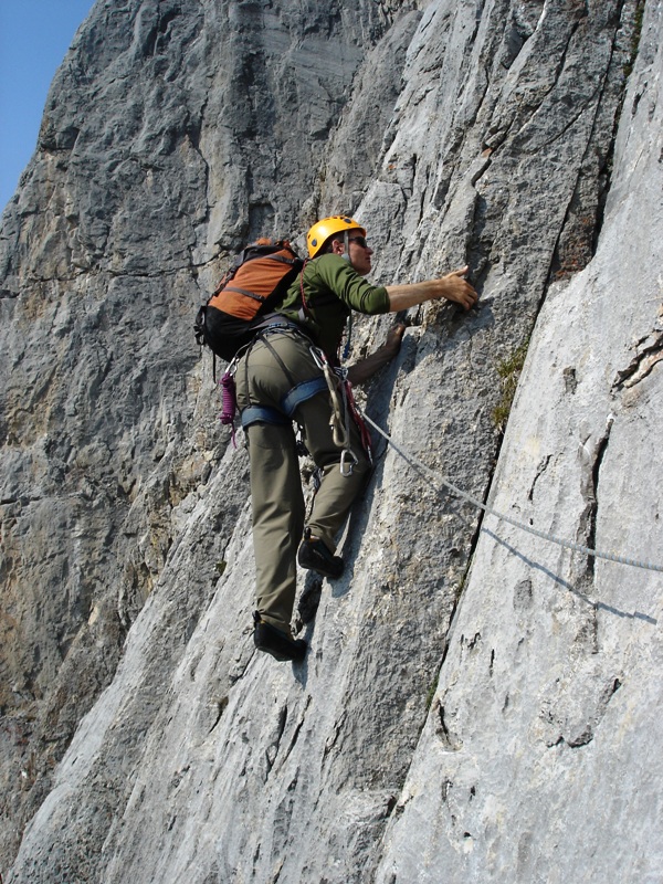
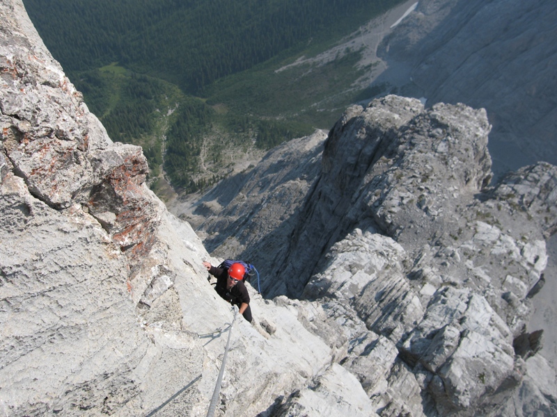
 We left the hut at 4 am the next morning and climbed up Little Robson by headlight (this was mostly 3rd and 4th-class rock mixed with some snow and verglas). This brought us to the "Schwartz Ledges", an exposed traverse that crosses beneath another band of seracs. |
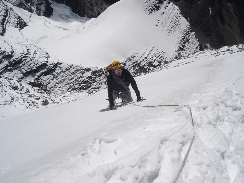
 Here I am on easier ground after the traverse of the Schwartz Ledges (they're just out of view below the bottom right of this picture). |
 After that we climbed a 45 degree snow-slope to reach a lower-angled rib. |
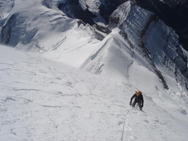
 Looking down at Little Robson (the rock buttress in the center-right of this picture). |
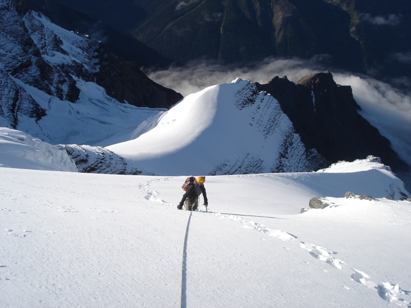
 Mike leading up the snow rib, with a very foreshortened view of the summit behind him – still well over 1,000' feet above us. |
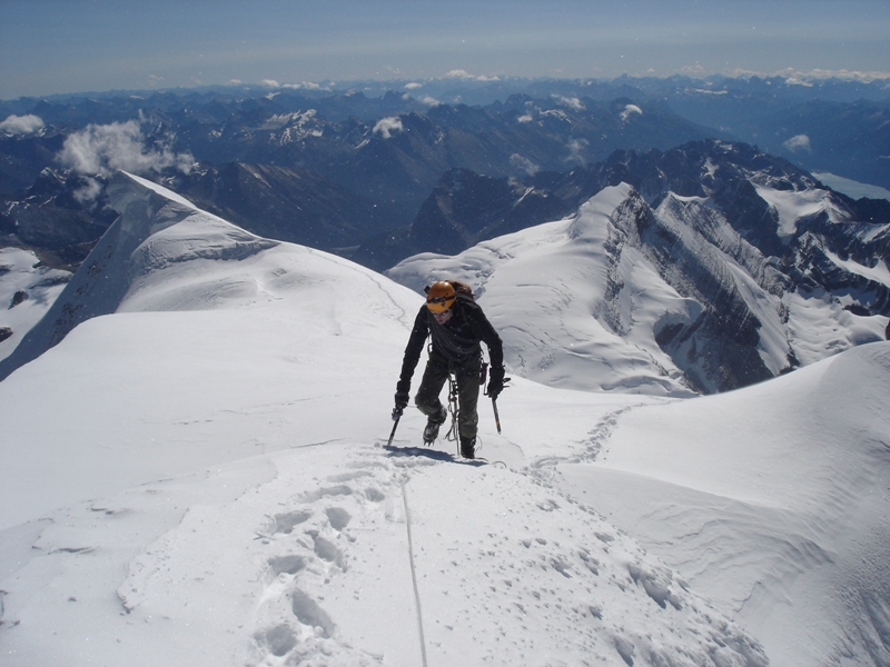
 Here I am approaching the top of the snow rib. |
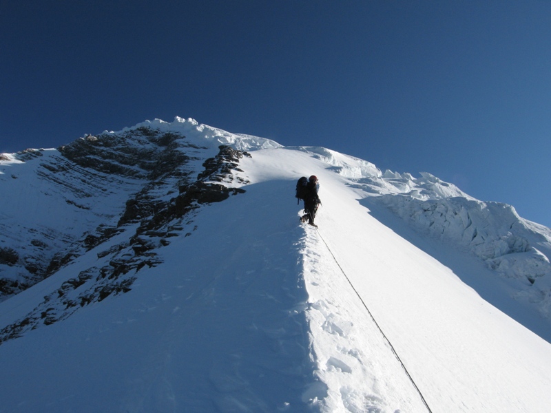
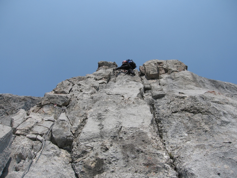
 This brought us to "The Roof", a low-angled bench that we followed across to the south-east ridge. |
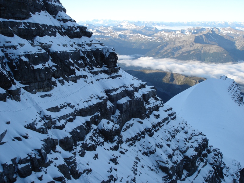
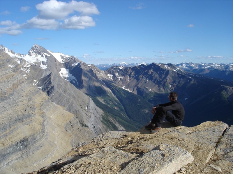
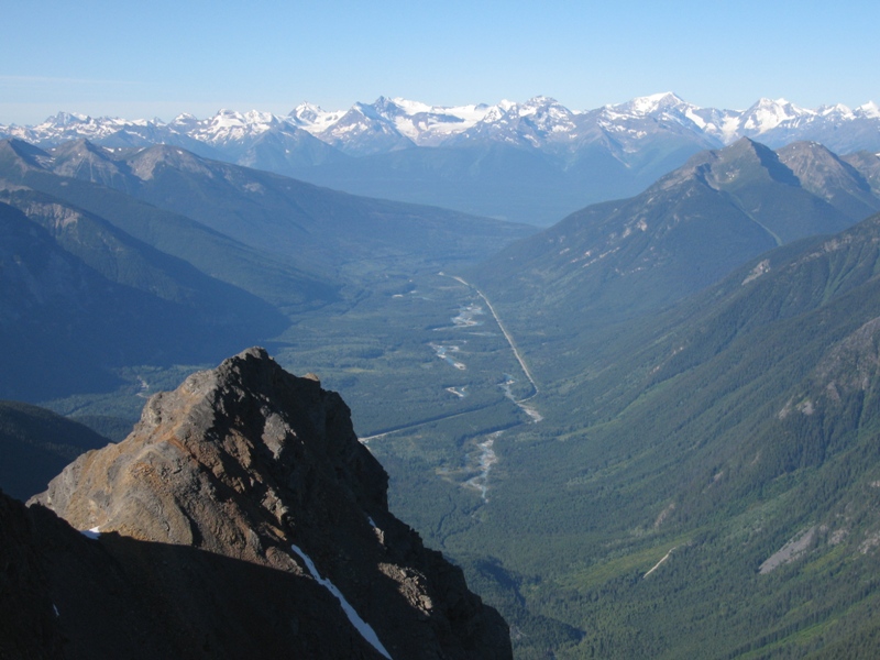
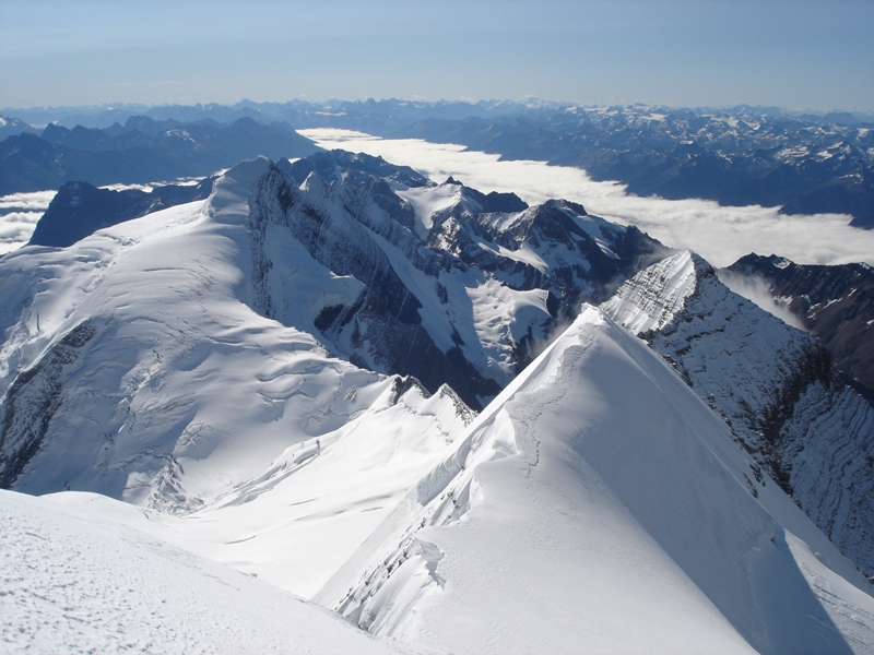 Looking down the south-east ridge towards the Kain face (45 degree slope seen in profile in the center of the picture). In the center-left is Resplendent Mountain, 11,240'. |
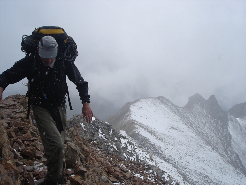
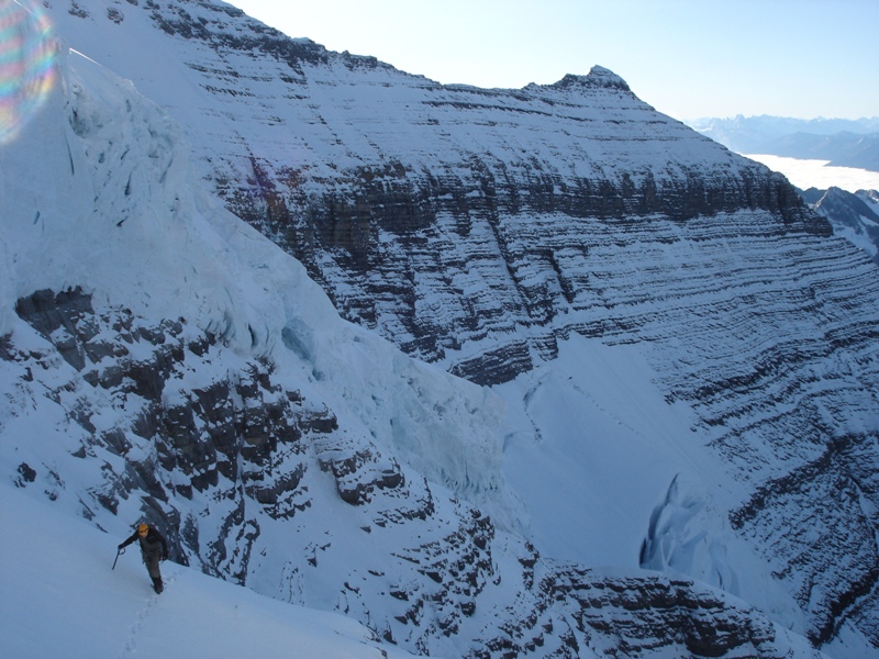
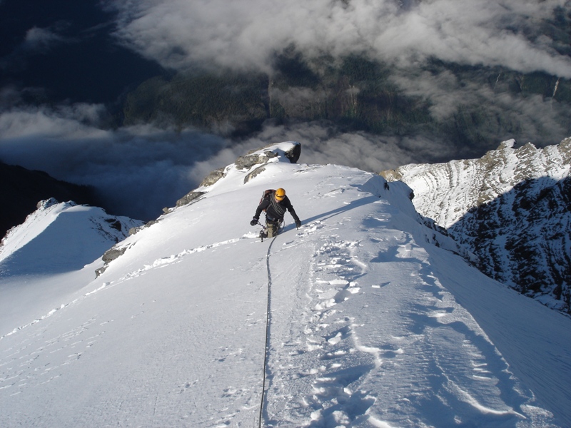
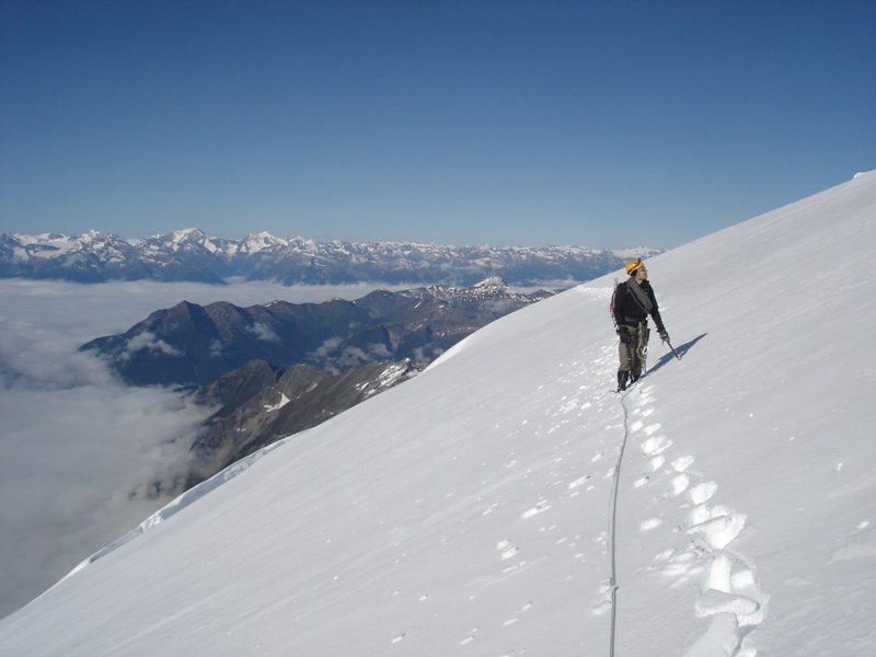
 Here I am on the south-east ridge. The guidebooks make this sound straightforward but we had to take a circuitous line on slopes of up to 50 degrees in order to outflank a number of serac barriers. |
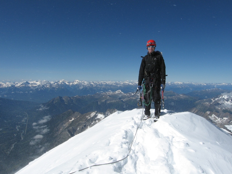
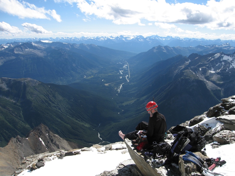
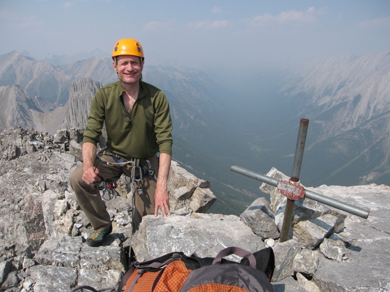
 This is me about to set foot on the summit. We reached the top around 11:30 am, about seven-and-a-half hours after leaving the hut. |
 Mike on the summit. We only stood here for a few moments because a fierce wind was blowing up from the other side. |
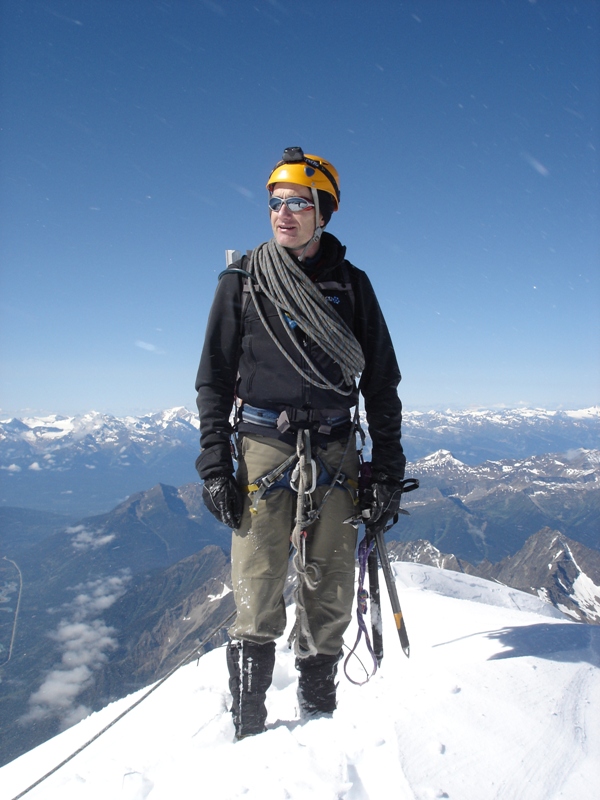 Me doing my best Edmund Hillary impersonation on the summit. |
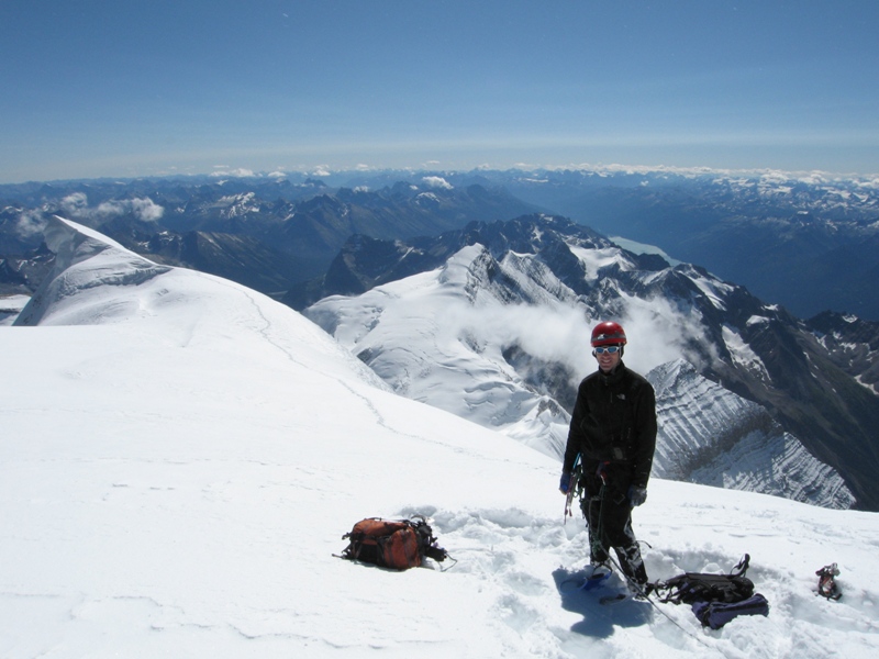 From the summit we dropped down a few feet to a relatively sheltered plateau where we had a quick bite to eat. We were both tremendously elated to have made it to the top, but were keenly aware that we had a long and exposed descent ahead of us. |
 This is me down-climbing one of the steeper sections on the south-east ridge. |
 Lower down on the descent of the south-east ridge. By now the wind was starting to pick up and spindrift was blowing off the summit. |
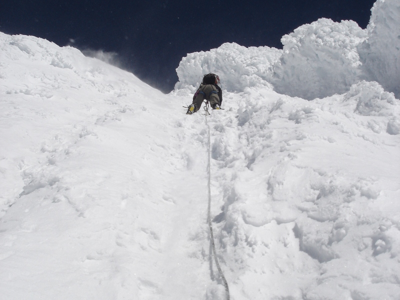
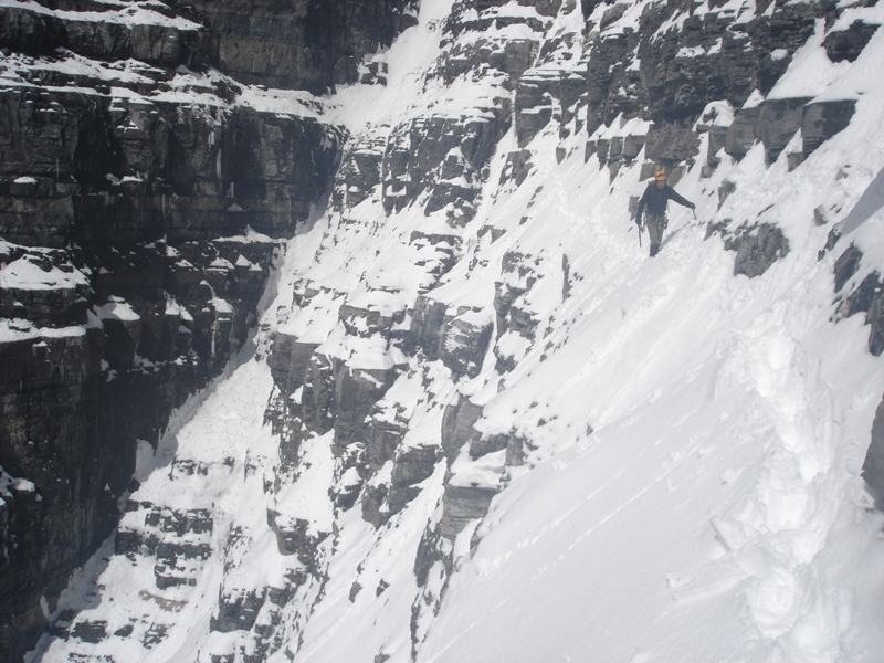
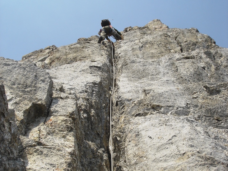
 Here I am climbing down towards the Schwartz Ledges. These slopes had been firm snow on the way up but they were now turning to slush overlaying rotten ice. |
 This is me racing back across the Schwartz Ledges, with the menacing serac barrier looming overhead. |
 Another view of me on the Schwartz Ledges. Supposedly these are quite easy when snow-free and dry, but they were very scary in the condition we found them. |
 With the Schwartz Ledges behind us the tension dissipated and we were finally able to relax a bit. Here I am at the top of Little Robson, with the south glacier below me. |
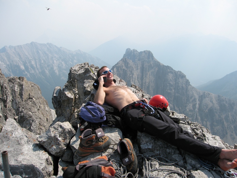
 Mike at the top of Little Robson, tending to his blistered toes and calling his family on a satellite phone. |
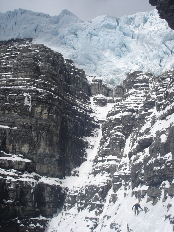
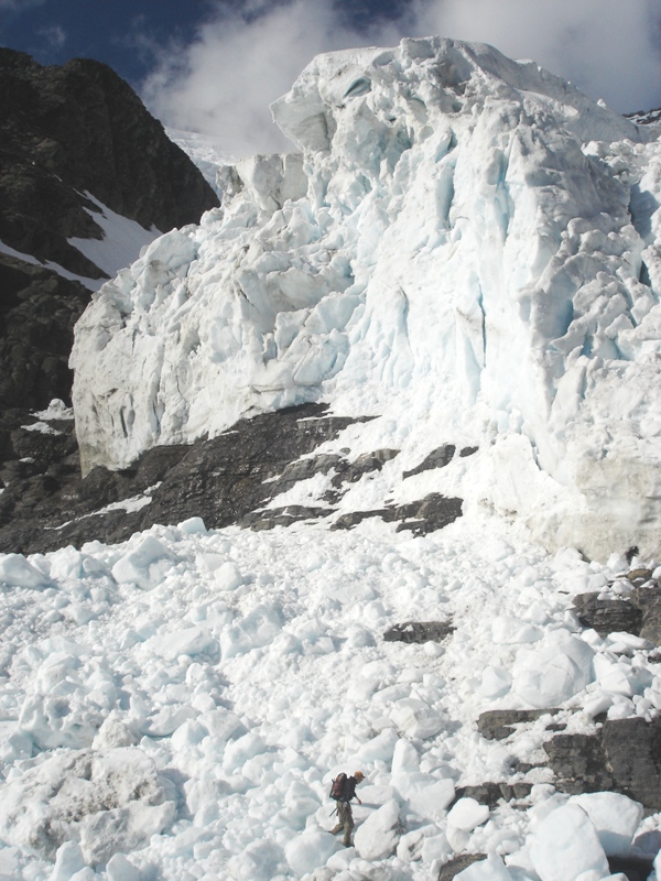 Scampering across icefall debris below the lower serac barrier, near the base of Little Robson. |
 Almost back at the Forster hut. It was about 6:30 pm, fourteen-and-a-half hours since we'd left. |
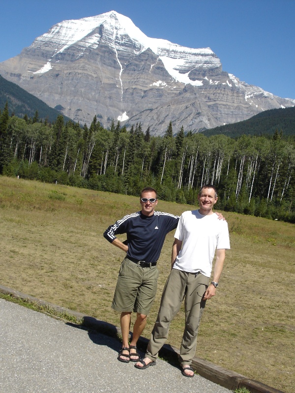
 Mike and me, happy to have made it to the top and safely back again. |
 Mike relaxing in the late afternoon sunshine on the ledge outside the hut. |
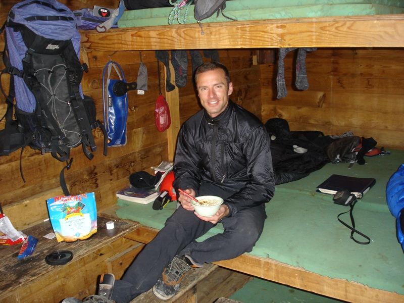 Mike tucking into a delicious dinner of freeze-dried something-or-another. |
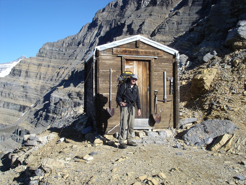 Here I am getting ready to leave the hut the following morning. |
 The view looking down from the Forster hut. |
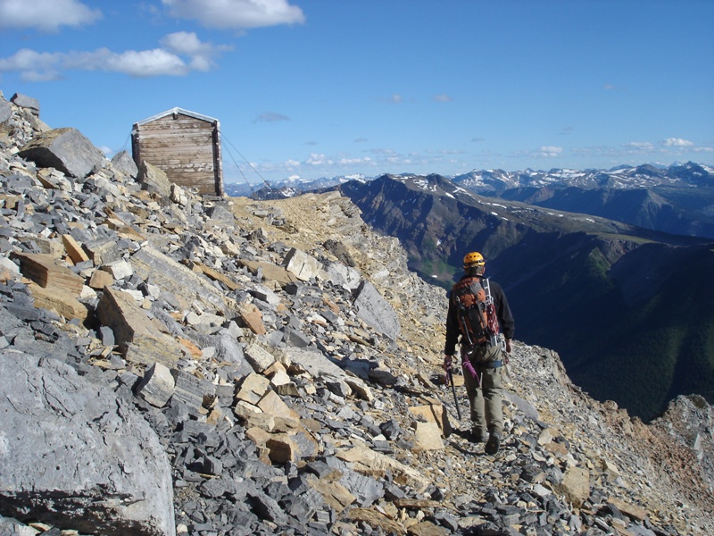
 Looking back up at the summit on the way down from the hut. It took us about three hours to get back down to the Berg Lake trail. |
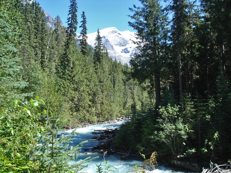 Resplendent Mountain and Robson Creek as seen from the Berg Lake trail. |
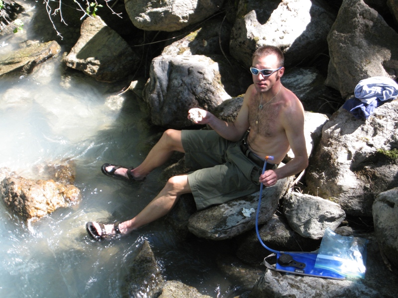 As soon as we got back to the parking lot Mike wasted no time in throwing off his boots and soaking his feet in the invigorating waters of Robson Creek. |
 A somewhat unbalanced tourist took this photo for us. |
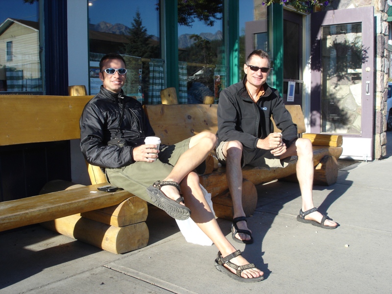 Relaxing outside the Bear's Paw Cafe in Jasper, Alberta the following morning. Note the identical clothing required of all successful Mt. Robson ascensionists. |
| I still had a few vacation days
left, but the weather forecast for the northern Rockies wasn't very
promising, so we decided to drive south to Banff and attempt Mt. Louis, a famous peak nearby. Mt. Louis is only 8,793' high but it's a freestanding rock pinnacle with no easy route to the summit. As with Mt. Robson we were attempting a route first climbed by the famous mountaineering guide Conrad Kain (he climbed Robson from the north in 1913 and the south in 1924, and Mt. Louis in 1916). Once again out trip had an inauspicious start. According to the directions in Sean Dougherty's infamous guidebook we were supposed to follow "a faint trail below the east side of Mt. Edith", so we dutifully located such a trail and were almost halfway up Mt. Edith before we realized we weren't in the right place. Eventually we turned around and found the correct trail, which turned out to be a well-used path with official Parks Canada signposts. Fortunately our detour didn't cost us more than an hour or so, so we still plenty of time to tackle Mt. Louis. |
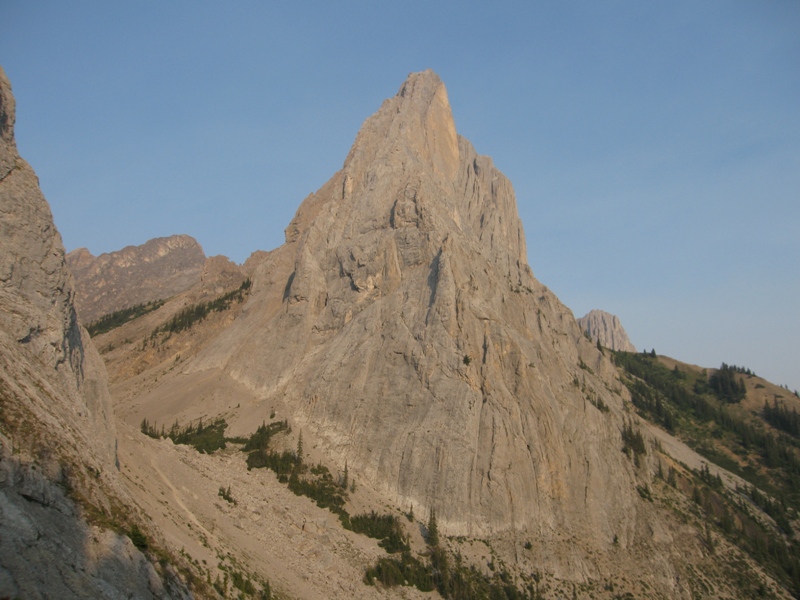 The south-east face of Mt. Louis. The Kain route starts near the bottom right and follows a leftward-trending line to the summit. |
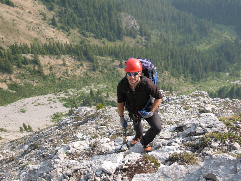 Mike on easy terrain near the start of the climb. We scrambled unroped for the first half of the climb. |
 About halfway up one come to a shoulder where one rappels down and traverses around a couple of ribs before continuing upwards. |
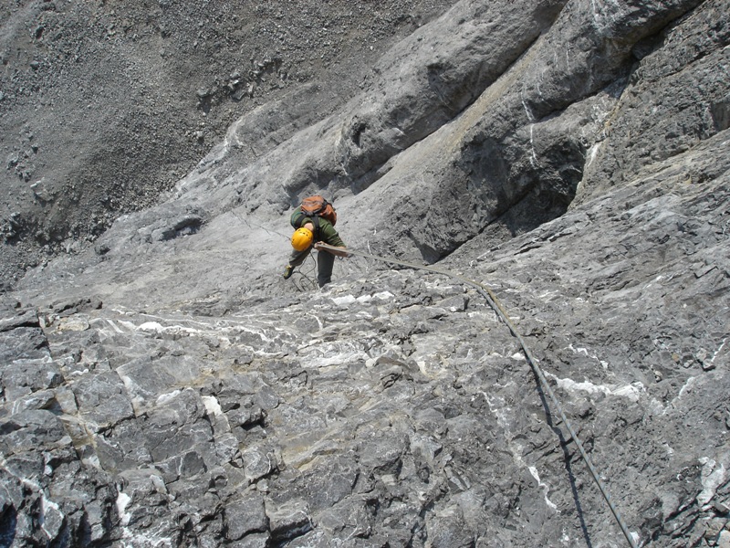
 After that it turns to 5th-class climbing, so we got the rope out and started swinging leads. |
 Here's Mike in the lead. Altogether we climbed about six or seven 5th-class pitches. |
 The crux of the climb is the "Perren crack" (actually more of a face climb), a steep 5.7 pitch just below the summit. Here I am leading up this. |
 Looking down at Mike as he follows the Perren crack. |
 We reached the summit at 2pm, about eight hours after leaving the car. Unfortunately it was very hazy because of some distant forest fires. |
 Mike sun-tanning on the summit (and chatting on the satellite phone). |
 The descent is by rappel. True to form, Dougherty claims that there are four rappels when actually there are seven of them. This is the last rappel before one gets back the ground. |