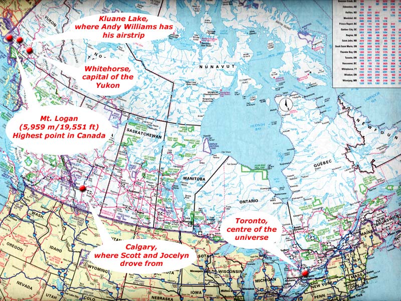
If you're wondering exactly where Mt. Logan is located, this map gives
all the details.
|
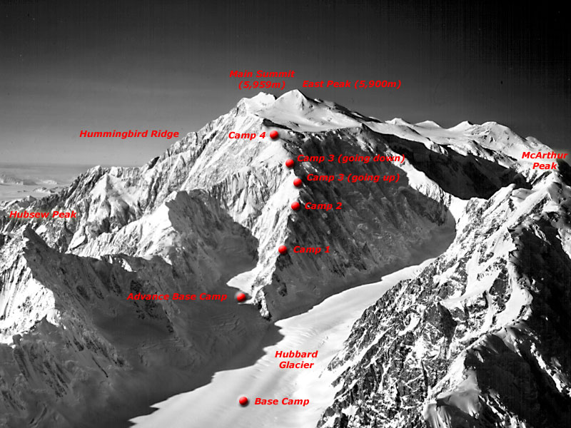
Aerial photo of Mt. Logan showing our camps.
Original photo: Bradford Wasburn collection, negative
no. 8509, Rasmuson Library, University of Alaska Fairbanks
|
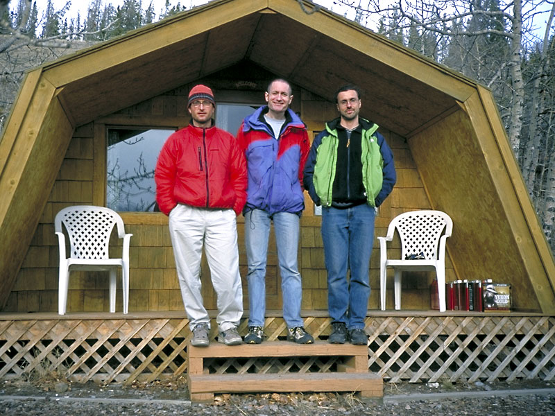
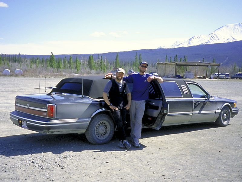
May 1: Scott, me and Jocelyn in front of our cabin at the Kluane Bed
& Breakfast. The weather was cloudy and windy when we arrived.
We had to wait four days until conditions improved enough to fly into
the icefields.
|
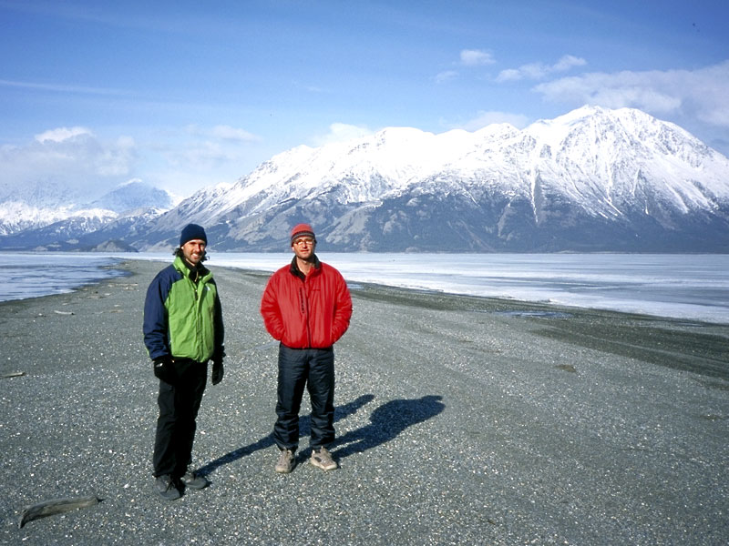
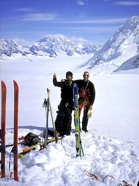
May 4: Scott and Jocelyn on the shores of Kluane Lake (still frozen).
The mountains in the background are the edge of the St. Elias range.
Mt. Logan is about 100km from here.
|
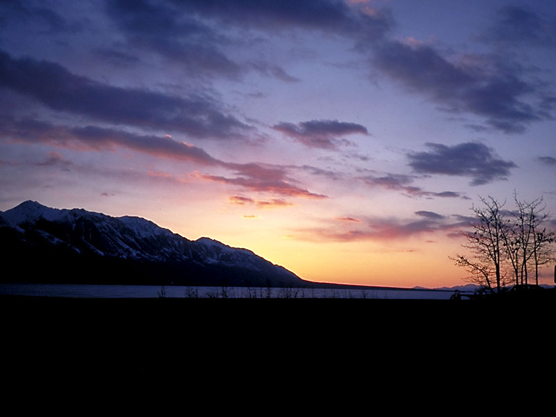
May 4: That evening the skies cleared and we had a nice sunset.
|
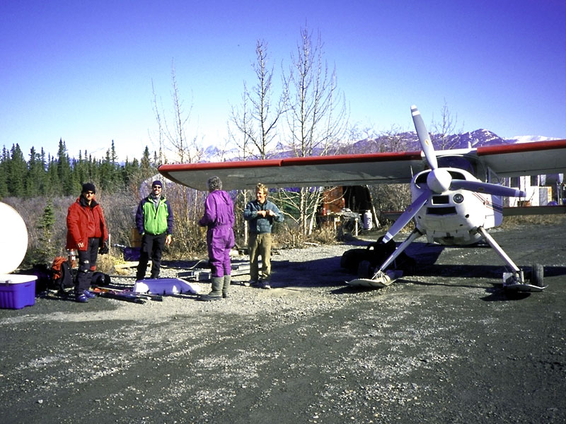
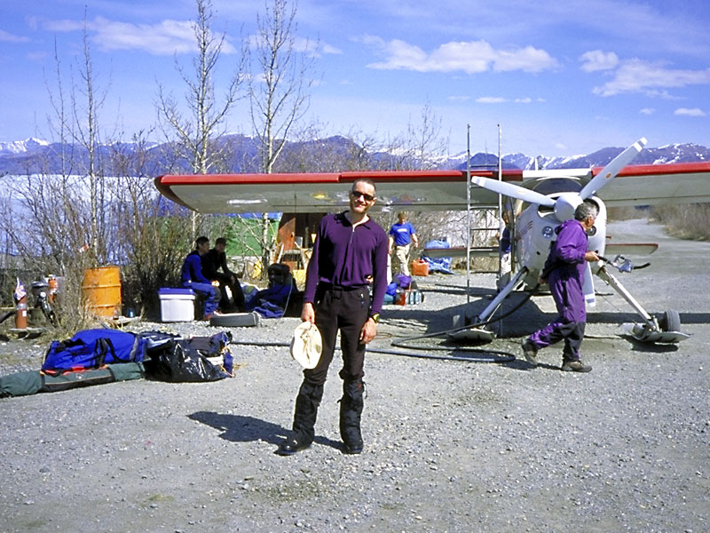
May 5: Finally the weather was good enough to fly. Here at
the Kluane Lake airstrip are Scott, Jocelyn, Andy Williams (pilot) and Andy's
faithful HelioCourier.
|
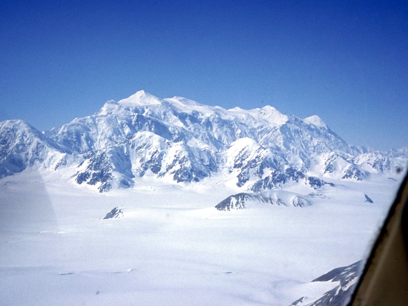
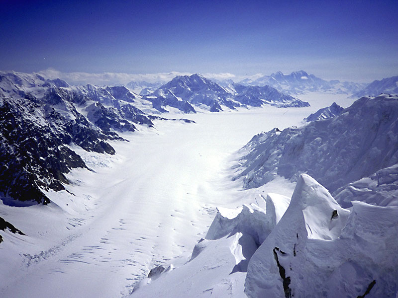
May 5: Our first view of Mt. Logan. It's almost worthwhile travelling
all this way just for the views from the flight.
|
May 5: Coming in to land on the Hubbard Glacier at the foot of
the East Ridge. It's difficult to grasp just how big this mountain
is – from the glacier to the summit there's over 3,800m in elevation gain.
|
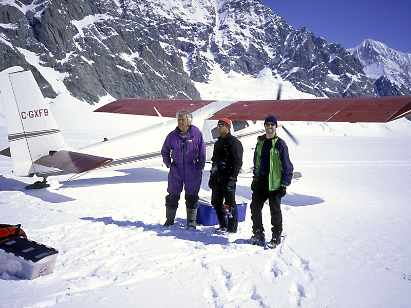
May 5: Andy, Scott and Jocelyn next to Andy's plane on the Hubbard
Glacier. The elevation here is about 2,150m.
|
May 5: By early afternoon the glacier can get surprisingly warm.
Here's Jocelyn working on his suntan.
|
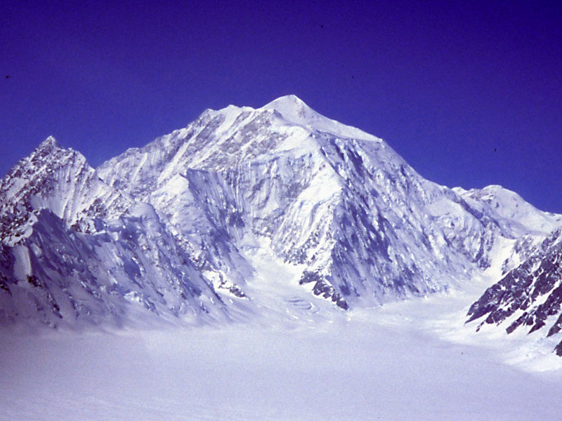
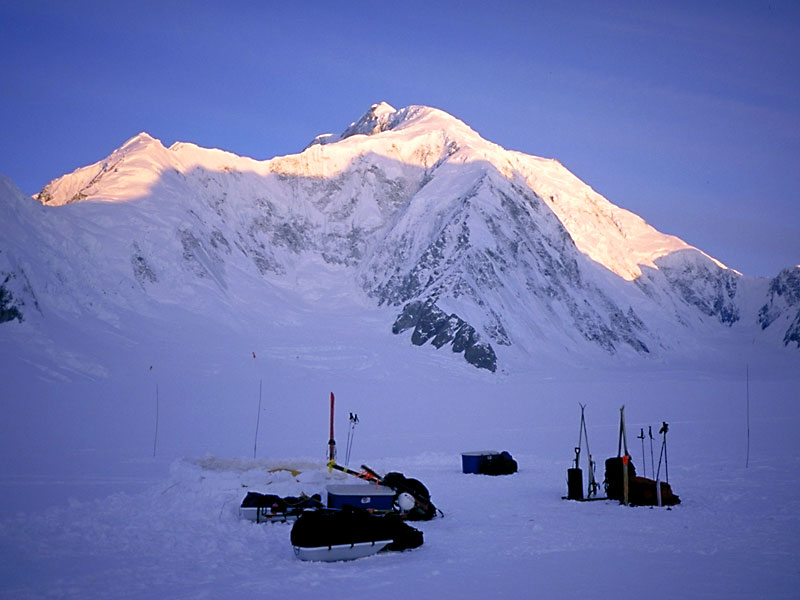
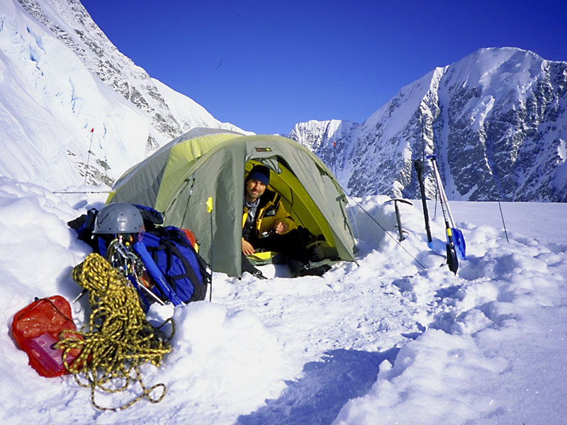
May 6: We had all taken Diamox to help with acclimitization. Diamox
is also a powerful diuretic and I had to step out of the tent early the
following morning. It felt about -30°C but I was rewarded with
this picture of the peak catching the first rays of the sun.
|
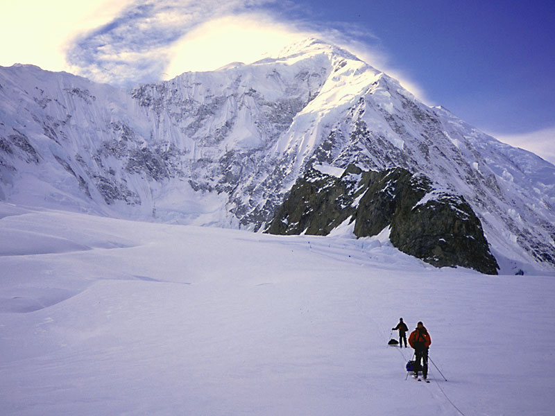
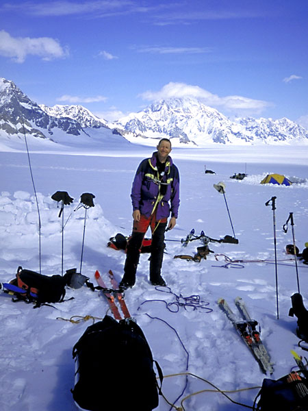
May 6: We loaded our gear onto sleds and skied up to Advance Base
Camp at the base of the East Ridge (2,450m). In the afternoon we carried
a load of food and fuel up to the ridge crest before returning to ABC for
the night.
|
May 7: Leaving our skis and sleds behind, we shouldered our packs
and headed up the ridge to Camp 1. This short 4th-class rock section
is about the only rock we encountered on the climb.
|
May 7: Further up the ridge on the way to Camp 1. The shadowy
figure in the middle of the rope is Jocelyn.
|
May 8: Jocelyn inside the tent at Camp 1 (3,150m).
|
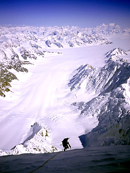
May 8: Scott on the way down to retrieve the supplies we had cached
earlier. In the centre background is Mt. King George, and on the
right in the far distance are Mts. Kennedy, Alverstone and Hubbard.
|
May 8: Andy Frisbie and Ryan Stefiuk, two climbers from Vermont that
we met on the ridge, setting out for Camp 2 in the late afternoon. Soon
afterwards they decided the snow was too soft and waited until early the
following morning instead.
|
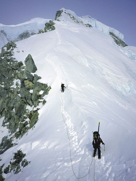
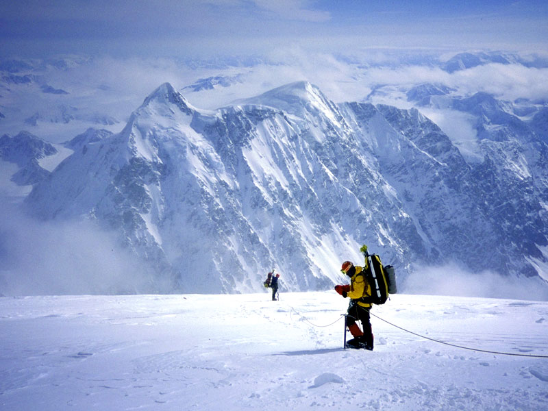
May 9: Scott (leading) and Jocelyn on the way up to Camp 2. Up on
the skyline is the start of the knife-edge ridge, the technical crux of
the route.
|
May 9: I don't have any photos of
the knife-edge on the way up, because the weather came in and we climbed
in a white-out. (But see below for some photos on the way down.) It
was tough going – most of the time we had to crampon sideways across steep
ice covered by just a few inches of snow.
|
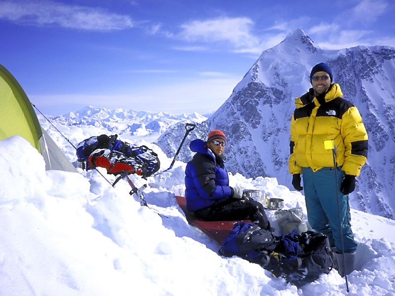
May 10: Scott and Jocelyn at Camp 2 (3,700m). In the background
is McArthur Peak and in the distance on the left is Mt. Walsh. We'd
climbed for 12 hours the previous day, so we decided to take a day off to
rest and acclimatize.
|
May 10: Another view from Camp 2. In the background is Hubsew
Peak and beyond it is Mt. Vancouver.
|
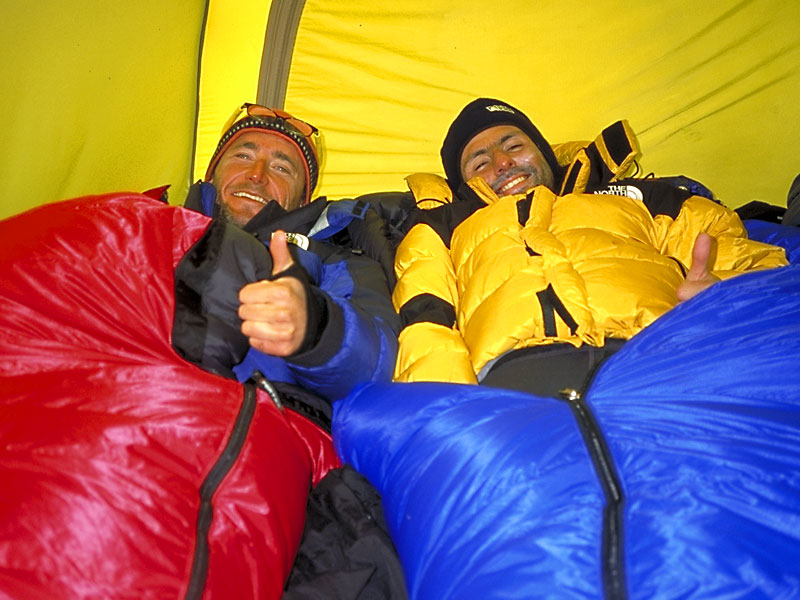
May 10: Scott and Jocelyn in the tent at Camp 2. Would you
want to share a tent with these guys for three weeks?
|
May 12: Jocelyn belaying Scott up a steep ice slope as we set out
from Camp 3 to Camp 4. I don't have any photos of the climb from Camp
2 to Camp 3 (3,820m) because once again we were caught in a white-out.
|
May 12: Andy and Jocelyn taking a break at 4,200m on the way up
to Camp 4. The clouds had come in earlier and for a while we thought
we might have to stop here, but then everything cleared up and we were able
to continue.
|
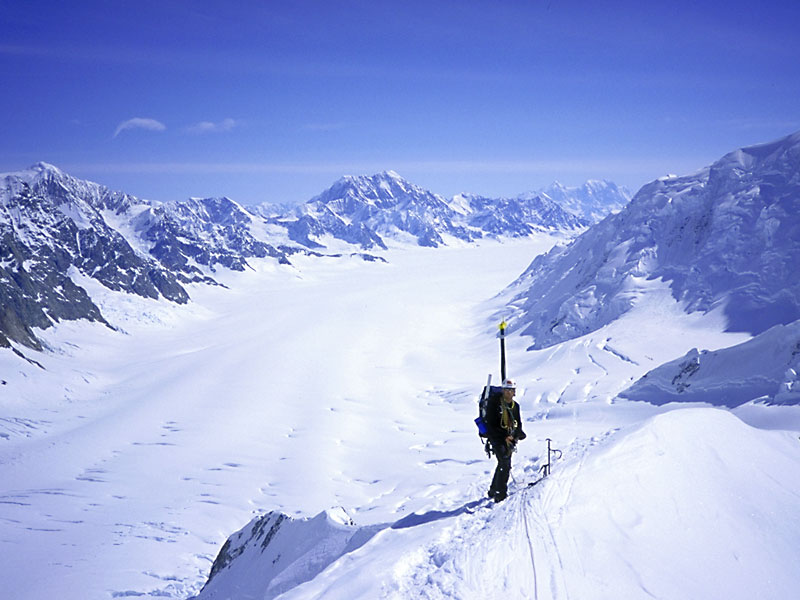
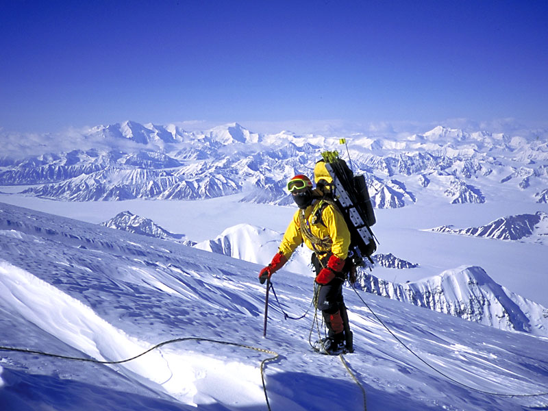
May 12: Andy just below the edge of the summit plateau, on the way up to Camp 4. The lower part of the East Ridge is visible far below.
|
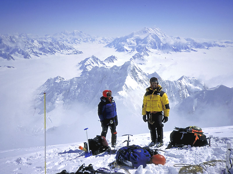
May 12: Ryan (in front) and Andy nearing Camp 4 (4,775m) on the
summit plateau. In the background is McArthur Peak.
|
May 12: Ryan arriving at Camp 4. On the horizon to the left
are Mts. Lucania and Steele, and to the right is Mt. Walsh.
|
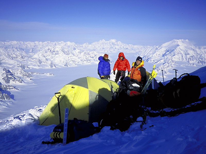
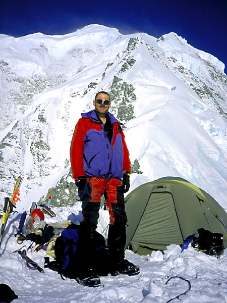
May 12: Scott, Andy and Jocelyn at Camp 4. The snow here was so hard we could barely dig
platforms for our tents. On the horizon to the right is Mt. Vancouver. Little did we know these would be the last good views we would get from here...
|
May 13 to 15: All the technical difficulties
were below us, and we were just a day's round trip from the summit, but the
weather never gave us a chance. We woke on May 13 to high winds and
white-out conditions, and it stayed that way for the next three days and
nights while we huddled in our tents. By May 15 our food and fuel were
running low and we decided to retreat as soon as there was a break in the
weather.
|
May 16: That morning it was very windy and the summit was still covered in cloud,
but there was enough of a break that we could see the way back down. Here
are Andy (in the lead) and Ryan setting out.
|
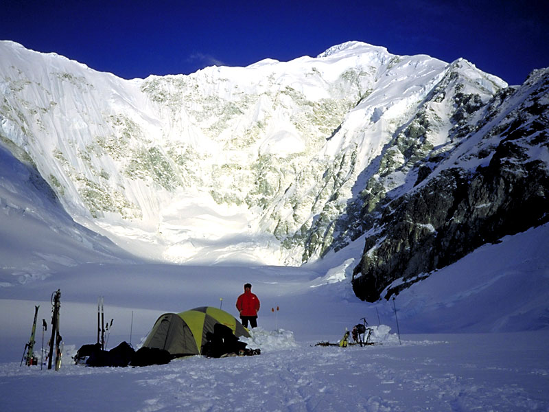
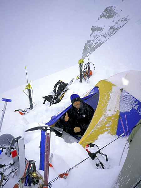
May 16: We only got down to 4,200m before the weather came in again,
so we stopped and set up camp. Here's Andy in his tent that afternoon.
|
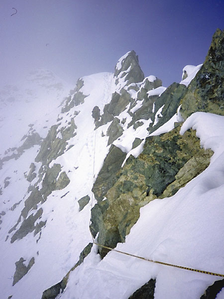
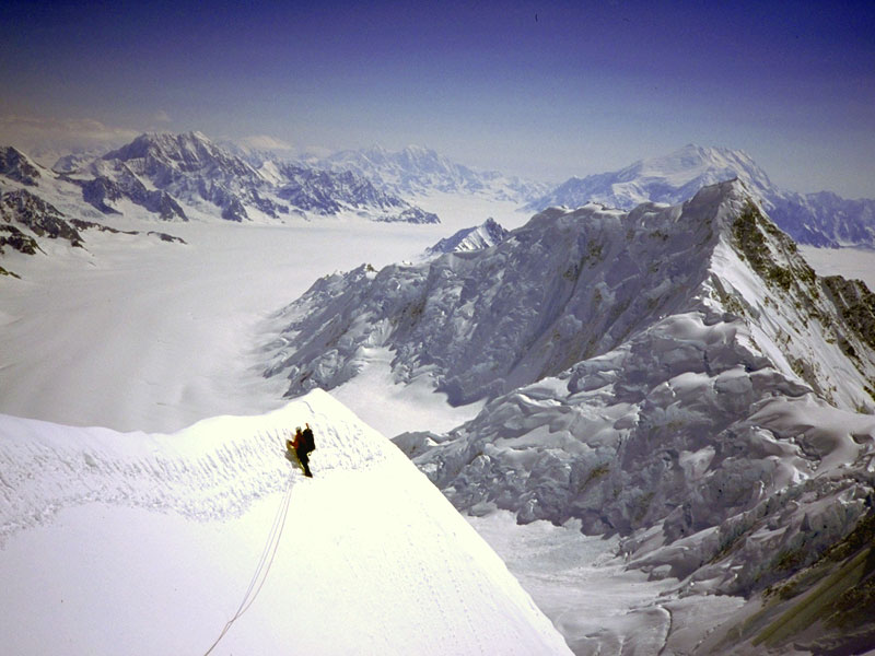
May 18: The knife-edge ridge below Camp 2. On the way
up we'd climbed up and over each of these pinnacles, but on the way down
we were able to rappel onto the snow ramp to their left and bypass some of
the difficulties.
|
May 18: Scott leading back across the knife-edge ridge.
|
May 19: Andy and Ryan made it from Camp 2 down to Base Camp in one
long day, but we mature folks took nine hours just to get down to Camp 1,
so we decided to stop for the night. Here I am the following morning.
|
May 19: Scott and me back at Advance Base Camp. We arrived
here in the mid-afternoon heat aften a exciting descent of an avalanche-prone
snow slope.
|
May 19: With skis on our feet and gravity in our favour we had a
rapid descent from ABC back to Base Camp.
|
May 19: Base Camp at last!
|
May 21: Lena, the queen of the glacier. She and her friends Merrie-Beth,
Jacqui and Kari greeted us at Base Camp, having skied 200km from
Skagway, Alaska. Their plan was to climb the East Ridge, descend the
other side of the mountain, and continue on skis to Cordova, Alaska, another 200km
away!
|
May 21: Scott, me, Jocelyn, Ryan and Andy at Base Camp. We waited here
for two days because the wind was too strong for Andy Williams
to fly. We were lucky – some of Andy's clients had been waiting eight
days by this stage.
|
May 21: At last the wind died down and Andy Williams was able to
fly in and collect us.
|